LaGrange County
Twelve open, eleven drawn
Published .
On the twenty-second of November, 1909, the Post Office Department's appointment register carried twelve post offices open in LaGrange County. On a map of the county the Department lettered with that date, eleven of them are drawn as post offices. The twelfth is drawn with a mark that matches neither of the two symbols the map's own legend gives.
The map is printed on one sheet, and its title says what it is: MAP OF LAGRANGE COUNTY, INDIANA, SHOWING RURAL DELIVERY SERVICE, POST OFFICE DEPARTMENT. Along the bottom edge, inside the border, a line is lettered as part of the sheet: C.W.K. NOVEMBER, 22, 1909. Immediately after it, on the same baseline, are the figures 7, 4-1-11, the 7 larger than the rest.

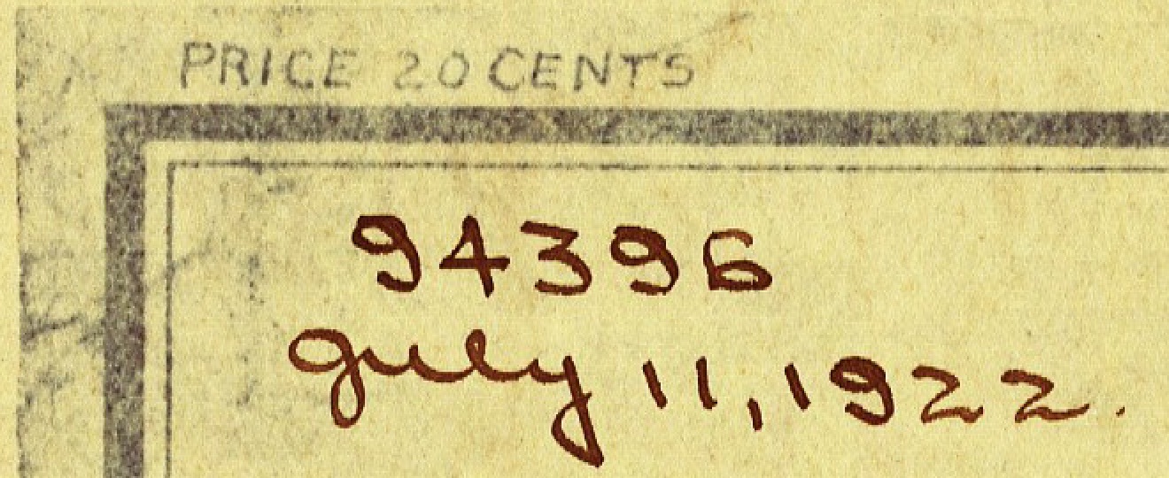
In the top left corner, above the border, the sheet prints PRICE 20 CENTS. It was a thing that could be bought, not only a drawing kept inside the Department. Below that, inside the border, someone has written in brown ink, by hand, 94396, and beneath it July 11, 1922.
The sheet's legend, which it heads EXPLANATION, gives a post office as a dot inside a ring and a discontinued post office as a circle with its right half filled.
Three lists of the county's post offices, twenty-seven years apart, do not count the same places.
In 1882 the county history counted them itself:
There are now sixteen offices in the county—La Grange, Lima; Scott, Van Buren Township; Ontario, Lima Township; Brighton and Greenfield Mills, Greenfield Township; Mongo and Brushy Prairie, Springfield Township; South Milford, Milford Township; Wolcottville, Woodruff and Valentine, Johnson Township; Steno, Clearspring Township; Emma, Eden Township; Pashan and Shore, Newbury Township.
In 1897 Galbraith's railway mail map of Indiana put twenty dots in the county. Thirteen of the names are on both lists. Three of Battey's sixteen are not on Galbraith's map: Steno, which the register discontinues on 19 February 1883; Shore, discontinued with its papers to Pashan in June 1891, the day not legible; and Pashan, discontinued with its papers sent to Shipshewana on 9 October 1891.
Seven of Galbraith's twenty are not in Battey, and for six of them the register's first entry falls after 1882. Shipshewana's first entry is dated 22 May 1889, Seybert's 24 August 1889 and Shrock's 18 September 1889. Plato's earliest entry on the pages read is dated January 1890, the day not legible. Eddy's first postmaster was appointed on 3 May 1893. Topeka is the office that had been Haw Patch: the register discontinues Haw Patch in 1877, appoints it a new postmaster on 19 January 1883, writes "to Topeka" against it on 11 August 1893, and carries the Topeka row with "Late" and Haw Patch's name in its margin. The seventh is Mount Pisgah. In the fifteen years after Battey wrote, the county's mail map was still being drawn outward.
By November 1909 the register shows twelve offices open. Nine of Galbraith's twenty had been discontinued. One had changed its name: the register's Lima row ends "Name Chgd. to Howe", and the next spread carries Howe with "Late Lima" in the margin, one office under two names. Mongo, on all three lists, had changed its name before any of them: the register marks the Mongoquinong row "Changed" and writes "to Mongo" against it, and carries Mongo with "Late Mongoquinong" in the margin. And one office was new: Stroh, whose first postmaster, William Hayward, was appointed on 26 January 1900, in the village that had first been called Hayward. Twenty, less nine closed, is eleven; with Stroh, twelve. The drop from Galbraith's twenty to the register's twelve is nine closures, one rename and one new office.
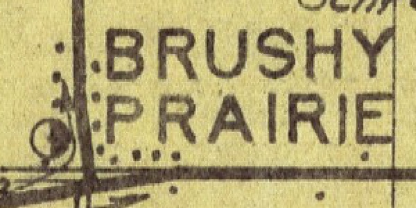
The sheet draws five offices with the discontinued symbol: Scott, Woodruff, Shrock, Mount Pisgah and Brushy Prairie. The register closes all five between 1905 and 1907. Woodruff was discontinued with its mail sent to Lagrange on 8 July 1905; Scott, mail to White Pigeon, Michigan, on 1 August 1905; Shrock, mail to Millersburg, on 2 January 1907; Mount Pisgah, mail to South Milford, on 17 April 1907; Brushy Prairie, mail to Lagrange, on 12 June 1907.
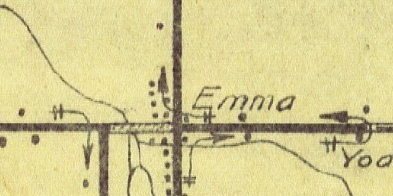
Four more offices on Galbraith's map closed earlier, and the sheet does not mark any of them as discontinued. The register discontinues Plato on 2 October 1901, the entry naming Lagrange, to take effect on the fifteenth. It discontinues Greenfield Mills on 22 January 1903, naming Lima, effective the thirty-first. Emma on 29 April 1903, naming Topeka, effective 15 May. Eddy on 2 May 1904, with its mail to Topeka, to take effect on the fourteenth.
On the sheet, Greenfield Mills and Emma are lettered in the small italic the sheet uses for the names beside its house dots, with no office symbol of either kind. Plato and Eddy are not lettered anywhere on it. That was established by reading every name on the sheet at full resolution, in twenty-five overlapping windows covering the whole county. The same reading found all twelve offices the register gives as open, the five discontinued names, and Greenfield Mills and Emma. The nearest string to either missing name is "Platz", lettered beside a house dot near Shipshewana. Nothing on the sheet comes near Eddy.
A third closed office's name may be on the sheet. "Shore" is lettered once, in the same small italic as the names beside its house dots, in Newbury Township, the township Battey puts the Shore office in; the register discontinues that office in June 1891. No household named Shore appears in Newbury Township in the federal census of 1900 or of 1910, read page by page; the nearest names are Shoup, Shaw and Shrock. The name is lettered in the township where Battey placed an office closed in 1891, and no family of that name was enumerated in that township in either year. Whether the sheet's "Shore" names the office cannot be told from the sheet.
So the discontinued symbol does not mean "closed". It marks the offices closed between 1905 and 1907 and none of those closed between 1901 and 1904. The sheet is a working drawing of routes as they ran in 1909, with the most recent closings still shown. It is not a list of the county's lost offices, and it cannot be read as one.
The twelfth open office is the one the sheet does not draw as open. The register discontinues Brighton on 30 June 1909, writing "Dis- June 30-1909.-", and on the same line appoints Ella J. Shattuck its postmaster on 16 September 1909. Sixty-seven days later the sheet was lettered with its date. The register discontinues Brighton again, finally, on 15 June 1911.
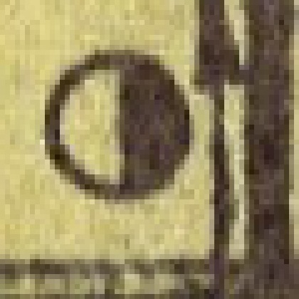
On the sheet, Brighton's symbol is a circle with dark fill over well over half of it. The edge of the dark area on its left is irregular, not the straight division of the discontinued symbol, and a small light patch sits at its upper left. It has none of the light ring inside the outline that every clear post office symbol on the sheet has. The dark areas are all one even tone, with no difference in color or density that would show one layer of ink over another, so whether the mark was drawn once or changed cannot be told from the image.


Twelve offices were open. Eleven are drawn open.
The sheet's title says it shows rural delivery service. Its EXPLANATION table lists twenty-four rural routes run from eight offices: four from Howe, eight from LaGrange, one from Mongo, three from Shipshewana, two from South Milford, one from Stroh, three from Topeka and two from Wolcottville. Each row gives a length in miles.
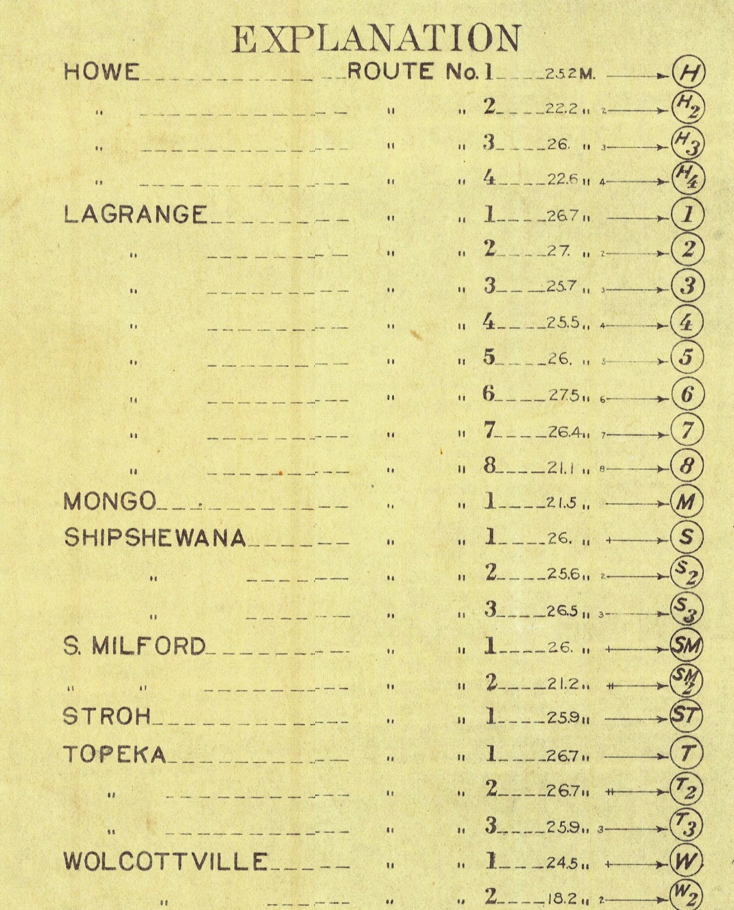
The sheet prints twenty-four route figures and no total. They add to 596.6 miles, an average of just under twenty-five miles a route, with none shorter than 18.2 miles or longer than 27.5. Routes run by offices outside the county also come in across its edges, lettered with their offices' names, among them White Pigeon and Sturgis along the Michigan line and Ligonier, Rome City, Wawaka and Kendallville along the south, with no lengths given.
The register gives, for each of the five offices drawn as discontinued, where its mail went. Three of the five sent it to Lagrange or South Milford, and both of those offices run routes on this sheet.
A map is a record of what somebody drew. This one was drawn with care: twenty-four routes, each mileage to a tenth, every office lettered, a price in the corner for anyone who wanted a copy. And on the date lettered along its bottom edge, the Department's own appointment book had one more post office open in this county than the Department's own map shows.
Sources
- Map of LaGrange County, Indiana, showing Rural Delivery Service, Post Office Department, 1909. Indiana State Library map collection, Indiana Memory, item p15078coll8/969, read from the library's JP2 master at 10500 by 8700 pixels. Every name on the sheet was read at that resolution in twenty-five overlapping windows.
- Record of Appointments of Postmasters, 1832-Sept. 30, 1971: LaGrange County, Indiana, Post Office Department, 1909. National Archives microfilm publication M841, Record Group 28, file units 78738088 and 78738094, read as page images through the National Archives catalog. The spread headed Lagrange County, Indiana, pages 267 and 268, for the offices open and closed from 1897 to 1911; pages 252 to 255 and 198 to 200 for the earlier entries named here; page 269 for Howe, late Lima.
- Counties of LaGrange and Noble, Indiana: Historical and Biographical, F. A. Battey & Co., 1882. Internet Archive, countiesoflagran00infaba, scan leaf 67, printed page 65, for the list of post offices, read off the page image.
- History of Northeast Indiana: LaGrange, Steuben, Noble and DeKalb Counties, Ira Ford, 1920. Internet Archive, historyofnorthea11ford, volume 1, printed pages 112 and 165, read off the page images, for Stroh first called Hayward.
- Twelfth Census of the United States, 1900: Population, Indiana, Census Office, 1900. National Archives microfilm T623, reel 383, via the Internet Archive, 12thcensusofpopu383unit, scan leaves 247 to 281, the Newbury Township schedules, every surname read off the page images.
- Thirteenth Census of the United States, 1910: Population, Indiana, Bureau of the Census, 1910. National Archives microfilm T624, reel 361, via the Internet Archive, 13thcensus1910po361unit, scan leaves 352 to 385, the Newbury Township schedules, every surname read off the page images.
- Illustrated Historical Atlas of LaGrange County, Indiana, Durant, 1874. Internet Archive, historicalatlaslag00dura, leaf 34, the Newbury Township plat, every landowner's name read at full resolution.
- Galbraith's Railway Mail Service Maps, Indiana, Galbraith, 1897. Library of Congress, Geography and Map Division, item 98688476, read from the library's image service at full resolution, the region covering LaGrange County.
The register is handwritten and every entry quoted here was read off the page image, with spelling, abbreviation and punctuation as the clerk wrote them. Battey's list was read off the printed page, not from its scanned text.
More from LaGrange County
LaGrange County
Takes its name from the village
In 1915 the United States Geological Survey named a landform after this county's seat, because the village stands on the seam where two ice lobes met. The county's own soil, its deepest wells and its best farmland are all explained by that seam.