Skip to content

History

Pieces

LaGrange

The courthouse they paid cash for

It cost seventy-five thousand dollars, took fifteen months, bankrupted its contractors halfway through, and when it was finished the county did not owe a dollar on it.
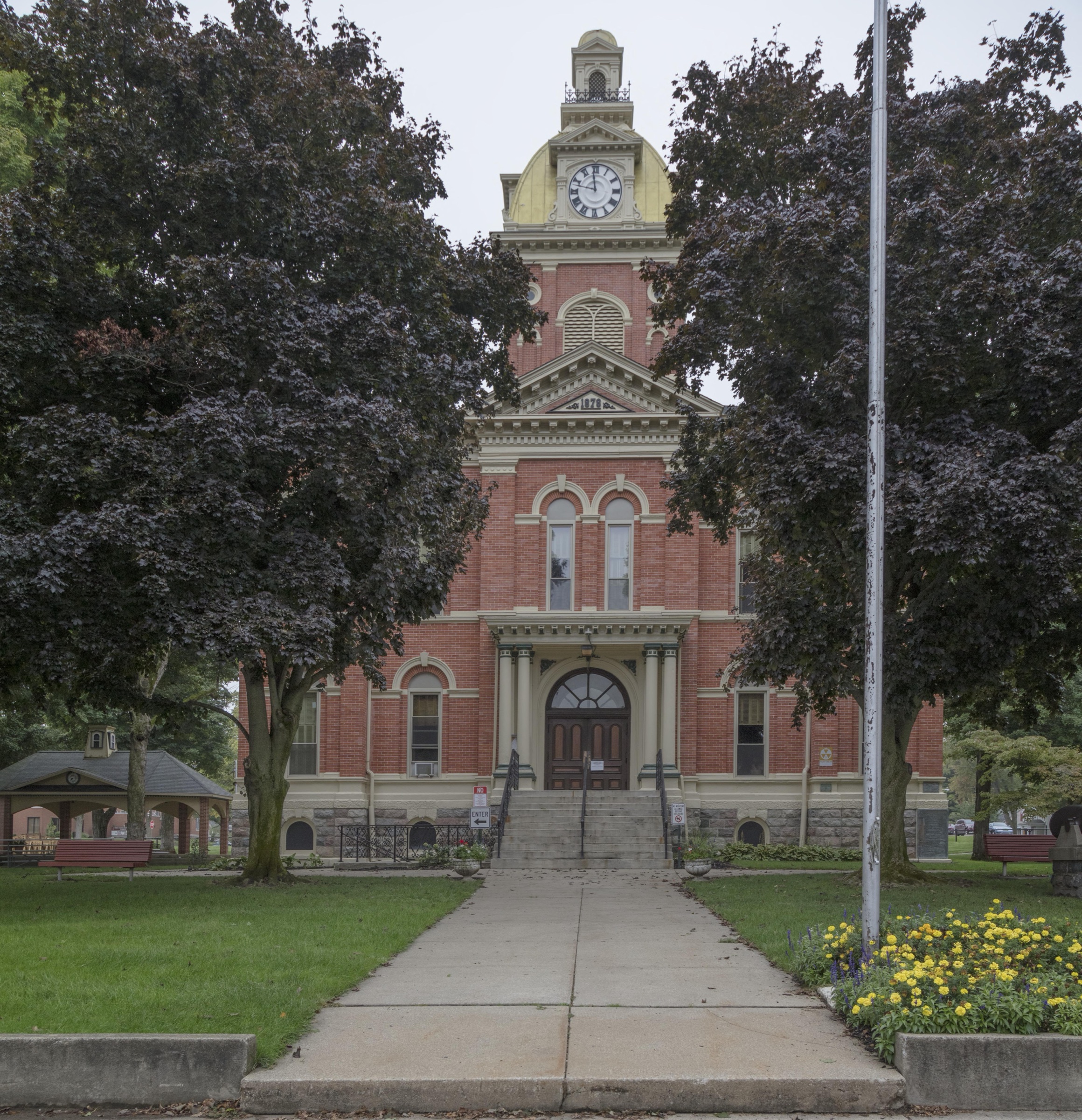
The LaGrange County Courthouse seen from the front walk, a red brick building with cream stone trim and a clock tower topped by a yellow dome, framed by two dark leaved maples, with a concrete walk running up to the arched entrance and marigolds along the edge of the lawn.

Photograph by Carol M. Highsmith, 2016. Carol M. Highsmith Archive, Library of Congress, Prints and Photographs Division. No known restrictions on publication.
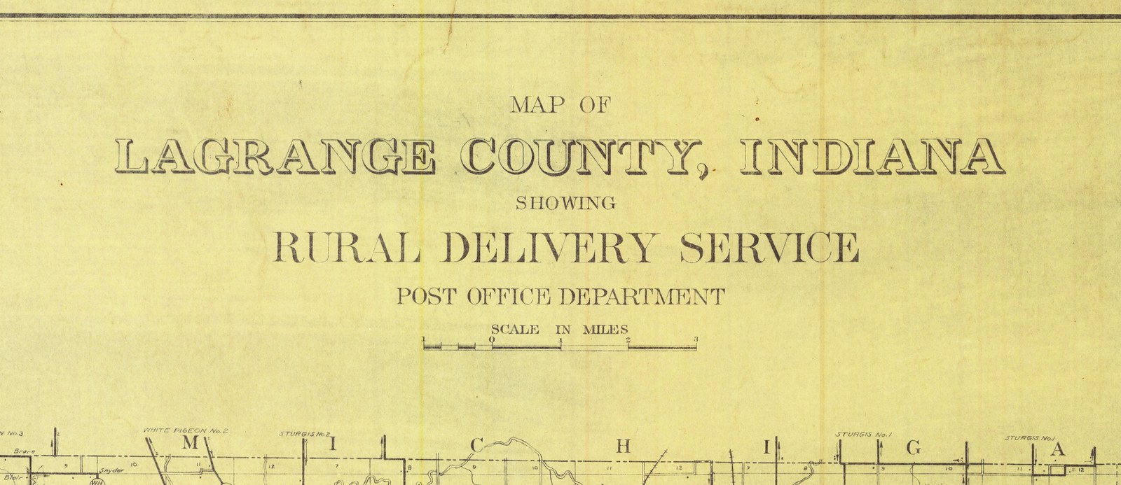
  • The title cartouche at the top center of the 1909 rural delivery map of LaGrange County, under the sheet's top border line. It is lettered Map of LaGrange County, Indiana, showing Rural Delivery Service, Post Office Department, with a scale in miles beneath. Along the bottom is the top edge of the county map, the state line with Michigan lettered along it and route labels for White Pigeon and Sturgis.

    LaGrange County

    Twelve open, eleven drawn

    The Post Office Department's 1909 map of LaGrange County draws its rural routes, eight offices that ran them, and the offices it had just closed. The register says twelve offices were open the day the sheet was finished. The sheet draws eleven.

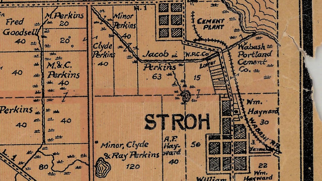
  • A detail of a printed county map on tan paper. At the top the words CEMENT PLANT sit beside curving lines of track at the edge of a lake; a parcel beside it is lettered Wabash Portland Cement Co. A railway runs down past a grid of town blocks lettered STROH and is marked WABASH R.R. at the lower right.

    Stroh

    Four hundred and eighty barrels

    In 1982 the county remembered a fishing trip, marl on a man's shoes and a thousand barrels of cement a day. The state geologist had recorded four kilns able to make four hundred and eighty. The records go on to say how the works ended.

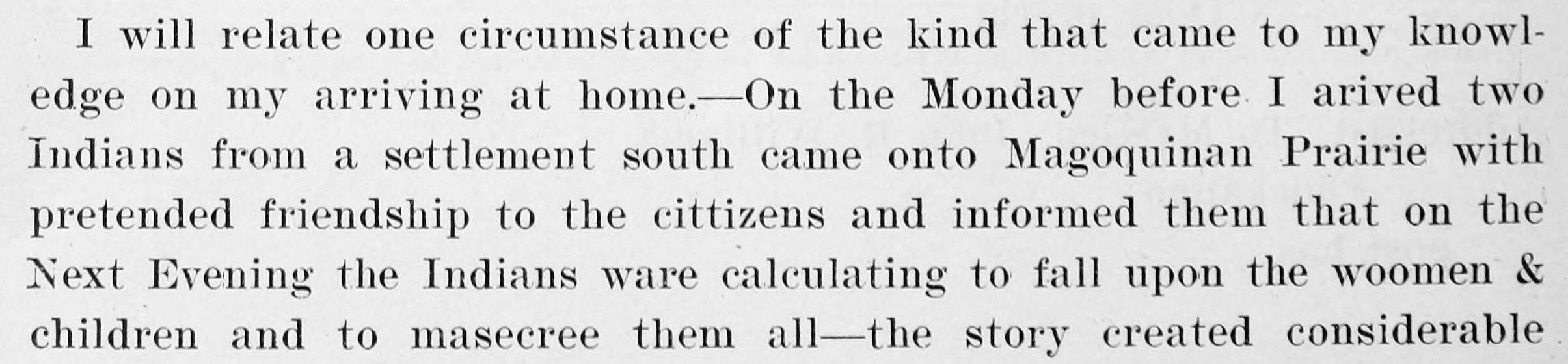
  • A cropped paragraph of printed type from an old book. Six lines in a serif face. The third line reads two Indians from a settlement south came onto Magoquinan Prairie, and the last line ends on the words the story created considerable. The last line runs to the edge of the crop mid sentence.

    LaGrange County

    They slept in the woods

    In June 1832 two men came onto Magoquinan Prairie and warned of an attack set for the next evening. Families left their houses and slept in the woods. A Michigan officer wrote it down at the time, in a letter none of the county's histories used.

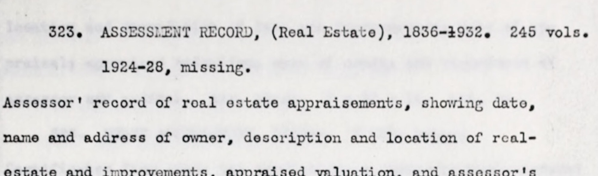
  • Two lines of typescript from a 1937 inventory, reading 323. ASSESSMENT RECORD, open bracket Real Estate, close bracket, 1836 to 1932, 245 volumes, and beneath it, indented, the words 1924 to 28, missing.

    LaGrange County

    No records could be found

    In 1937 a federal survey counted what this county had kept. It found the commissioners' minutes running unbroken from 1832, and three holes: two gaps in the tax books, and an office whose records could not be found at all.

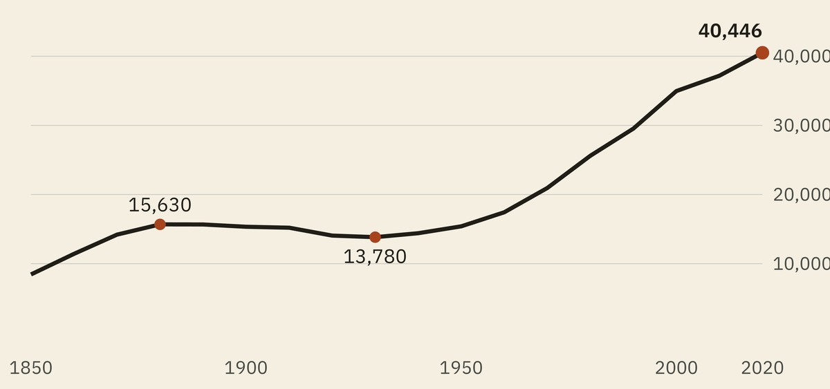
  • A line chart of the county's population at every census from 1850 to 2020. The line rises to a shoulder around 1880, runs almost level and then sags to its lowest point in 1930, and climbs steeply from the middle of the century to end at its highest point, marked 40,446.

    LaGrange County

    The county's smallest century

    Both of this county's histories were written while it was shrinking. The federal count says its nineteenth century was its smallest, and that every one of its eleven townships is larger now than it has ever been.

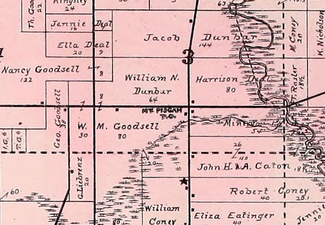
  • A detail from an 1893 township plat, printed in pink, showing a grid of farm parcels with each owner's name and acreage written across it. In the middle, in small bold capitals set level beside the corner where a road running east and west meets one running north and south, the words MT. PISGAH with P.O. beneath them. The section number 3 stands just above on the north and south road. The names around it read William N. Dunbar 64, W. M. Goodsell 80, Jacob Dunbar 144, Harrison Deal 80, Nancy Goodsell 122 and John H. and A. Caton. A small star stands a short distance to the south. No town lots or streets are drawn anywhere near the name.

    Milford Township

    The office the county history buried

    The 1882 county history mentions Mount Pisgah once, in another man's biography, as a post office that used to exist. The Post Office Department went on listing it for another twelve years.

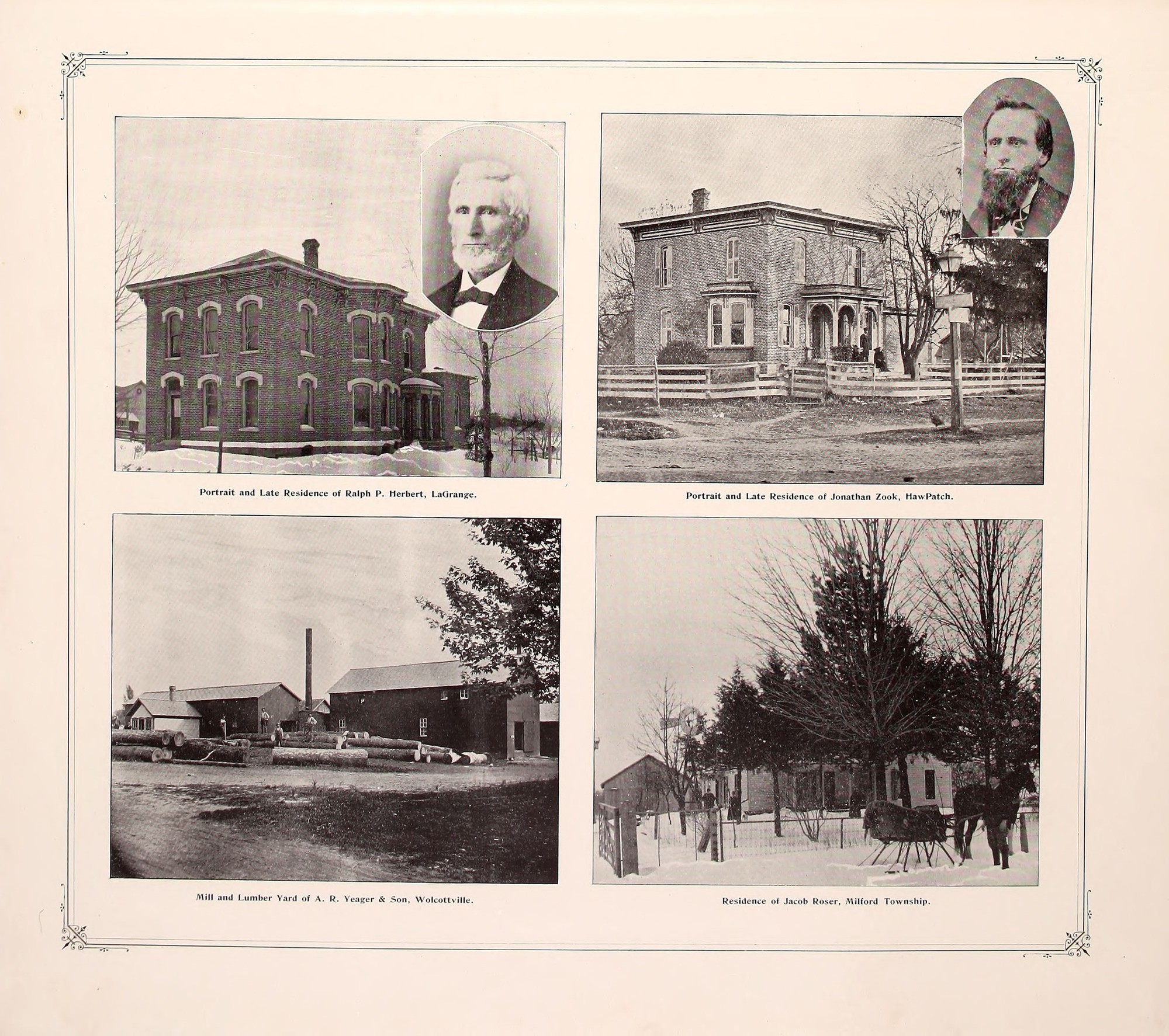
  • A page from an 1893 county atlas inside a ruled border with ornamented corners, holding four photographs in two rows. Top left, a two storey brick house with arched windows in snow, with an oval portrait of an elderly man with a white beard and a bow tie. Top right, a two storey brick house with a bay window and an arched porch behind a board fence, a lamp post with a signboard at the roadside, and an oval portrait of a man with a long dark beard. Bottom left, a lumber mill with sheds, a tall chimney and logs in the yard. Bottom right, a house among evergreens in snow, with a horse and sleigh at a picket fence. Each photograph has a printed caption beneath it.

    Clearspring Township

    The Zook self-opening gate

    The 1893 county atlas remembers Jonathan Zook of Hawpatch for the Zook self-opening gate. The Patent Office granted it in July 1883 as a gate, and printed the village it came from as Hanpatch.

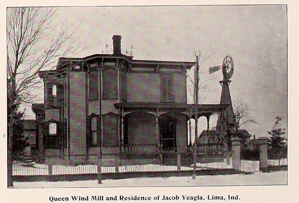
  • A photograph printed in an 1893 county atlas. A two storey house with a bay window, a deep porch and a brick chimney stands behind a picket fence, with bare trees at either side. To the right of the house a wooden tower rises to a bladed wheel and a tail vane. A printed line beneath the photograph reads Queen Wind Mill and Residence of Jacob Yeagla, Lima, Ind.

    LaGrange County

    Two windmills from Lima and a traction engine from Sturgis

    The 1920 county history remembers Isaac Lehmer as inventor of one of the first traction engines. He patented two windmills from Lima in 1871 and 1872, and the traction gear in 1885 from Sturgis, Michigan. The county kept the memory and lost the man.

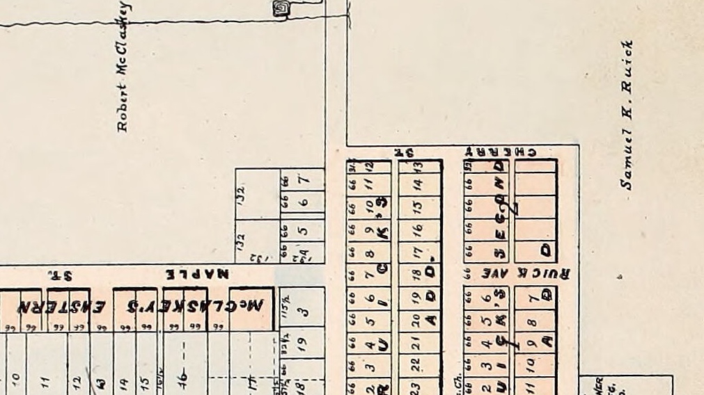
  • A detail of a printed town plat. Across the open ground at the upper left, in script, the name Robert McClaskey. Down the right margin, in the same script, the name Samuel K. Ruick. Between them a grid of numbered lots tinted pink, with RUICK AVE lettered along one street and SECOND and CHERRY along others. Across the lower left, MAPLE ST. and the words McCLASKEY'S EASTERN, the beginning of the addition's name, run along a row of lots each marked 66 feet wide.

    LaGrange

    Fourteen streets and not one of their own

    Four men platted this county's seat in June 1836 and named fourteen streets. Not one of the fourteen carries a name of the four. The surnames that did reach the map arrived thirty years later, through additions their owners laid out themselves.

  • Howe

    Sixty miles east of Bertrand's

    In 1824 the Governor of Michigan licensed a trader at the Potawatomi village where Howe now stands, five years before the first settler opened a post there. The government listed the place among its posts of trade, and measured its position from Michigan.

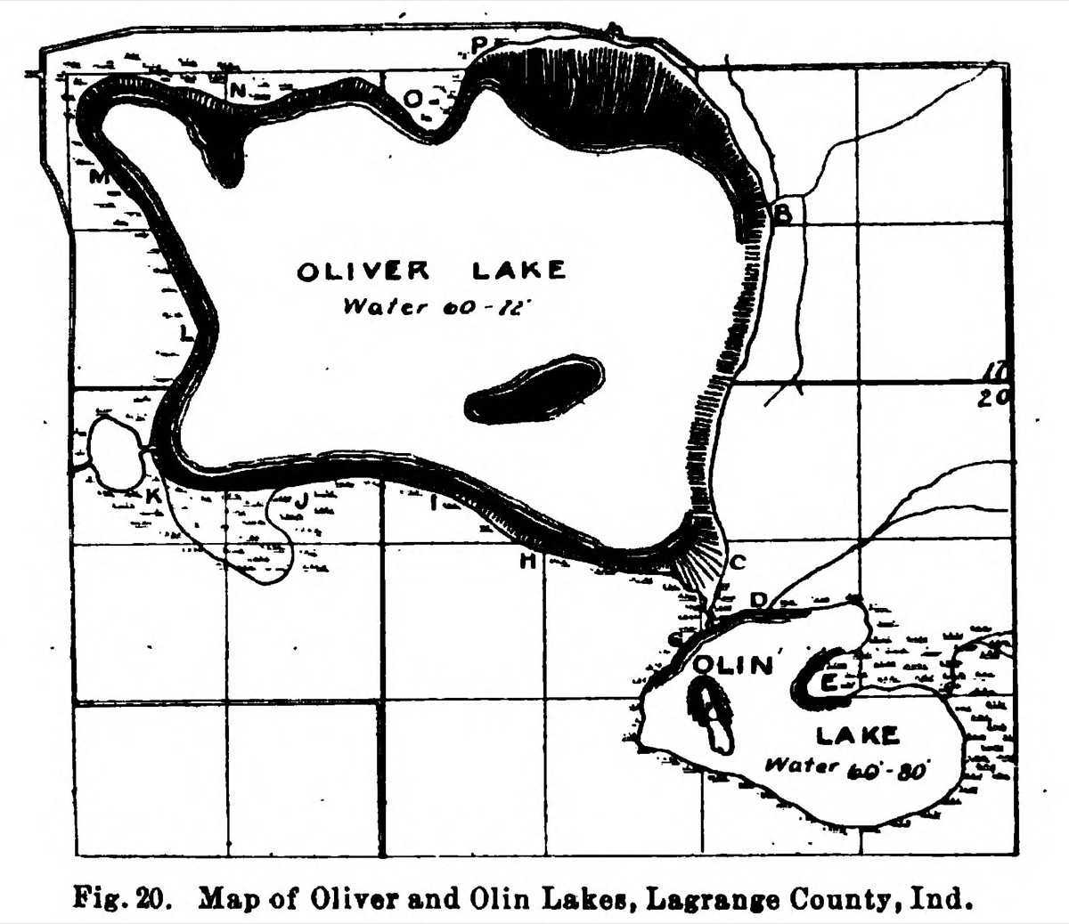
  • A line map of two lakes drawn inside a ruled grid of section lines. The larger lake fills most of the frame, its shore drawn as a heavy black band with fine hatching beyond it, and is lettered OLIVER LAKE with the words Water 60-72 beneath. A small dark island sits near its centre. Below and to the right a smaller irregular lake is lettered OLIN LAKE with Water 60-80 beneath it. Single letters from A to P mark test points around both shores. A caption below the frame reads Fig. 20. Map of Oliver and Olin Lakes, Lagrange County, Ind.

    LaGrange County

    Takes its name from the village

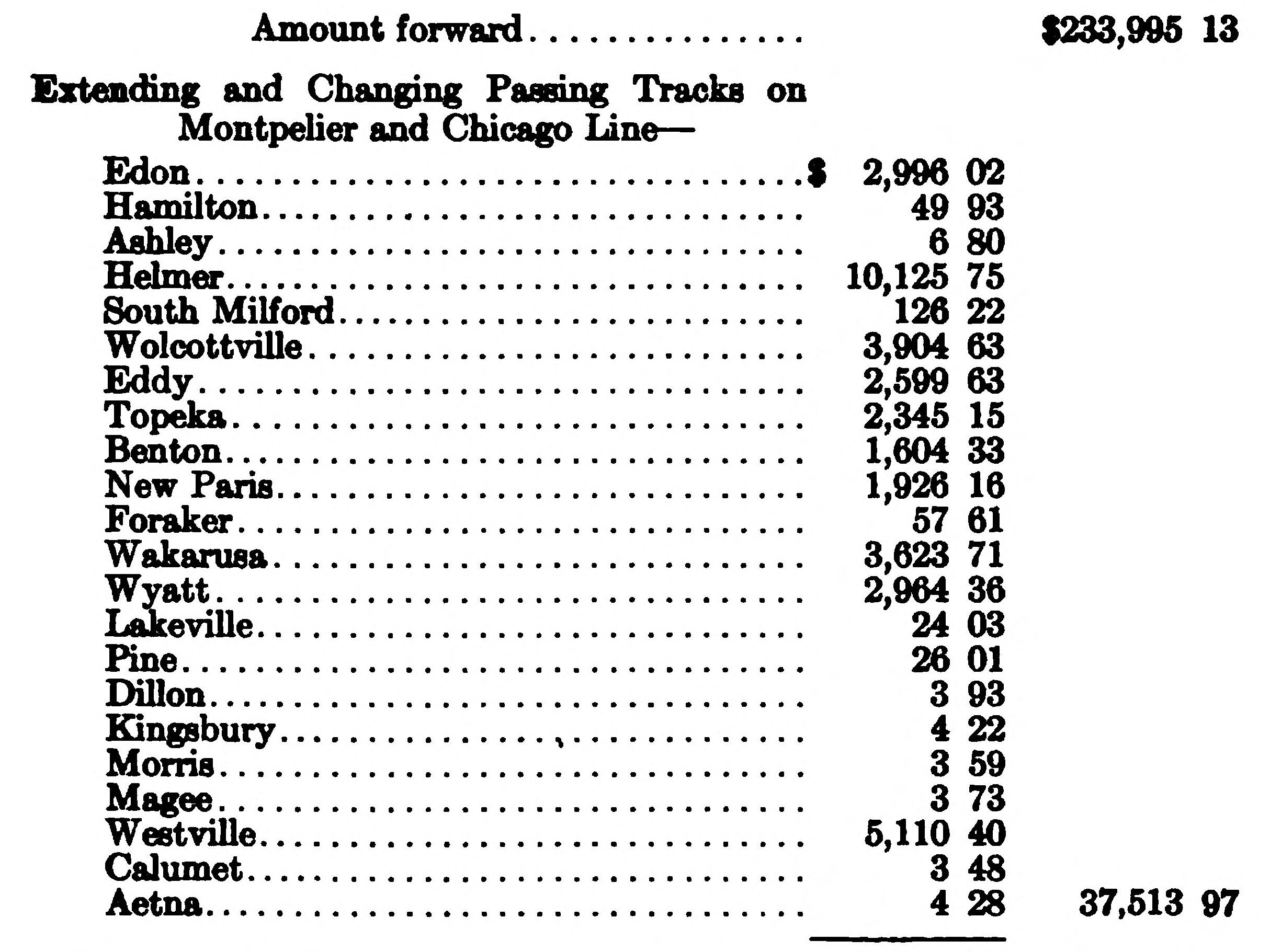
    In 1915 the United States Geological Survey named a landform after this county's seat, because the village stands on the seam where two ice lobes met. The county's own soil, its deepest wells and its best farmland are all explained by that seam.

  • A printed page of railroad accounts. A bold heading reads Extending and Changing Passing Tracks on Montpelier and Chicago Line, above a column of station names with dotted leaders and dollar amounts: Edon, Hamilton, Ashley, Helmer, South Milford, Wolcottville, Eddy, Topeka, Benton, New Paris, Foraker, Wakarusa, Wyatt, Lakeville, Pine, Dillon, Kingsbury, Morris, Magee, Westville, Calumet and Aetna. An Amount forward line of $233,995.13 sits above the heading and the entry totals $37,513.97.

    LaGrange County

    Legally called

    For twenty-three years the Wabash through the south of this county was, on paper, another company. The state taxed it under that name, the railroad kept its accounts under it, and none of the county's own books ever used it.

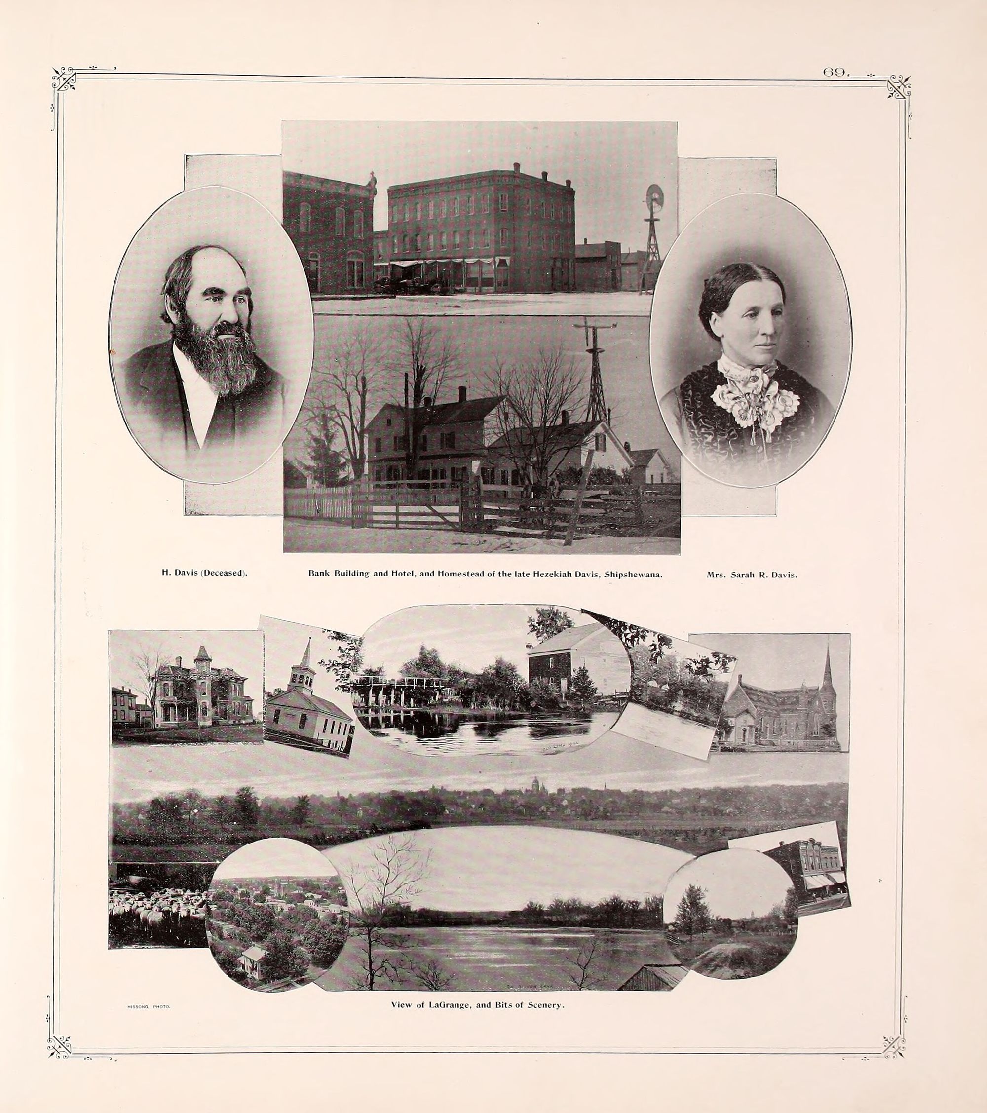
  • A page from an 1893 county atlas inside a ruled border with ornamented corners. Across the upper half, an oval portrait of a man with a full dark beard at the left and an oval portrait of a woman at the right, her hair parted in the middle and drawn back, a dark bodice and a white lace jabot at her throat. Between them two photographs stacked one above the other: a three storey brick business block on a snowy street with a windmill beyond it, and below that a two storey frame farmhouse behind a board fence and a gate. Under the upper group a single line of three captions. The lower half is a montage of smaller photographs of houses, a church, a lake and a view across a town.

    Shipshewana

    Now president

    Sarah Reynolds Davis was president of a Shipshewana bank for fourteen years. The 1893 atlas photographed her beside it, gave the building to her dead husband in the caption, and named her president in the text. No county history records when she died.

  • LaGrange County

    Similarly honored

    When the county histories knew a lake was named after someone, they said so. When they did not, the grammar changed. Four lakes are named outright, three are only known as, several have a family nearby, and one has nobody.

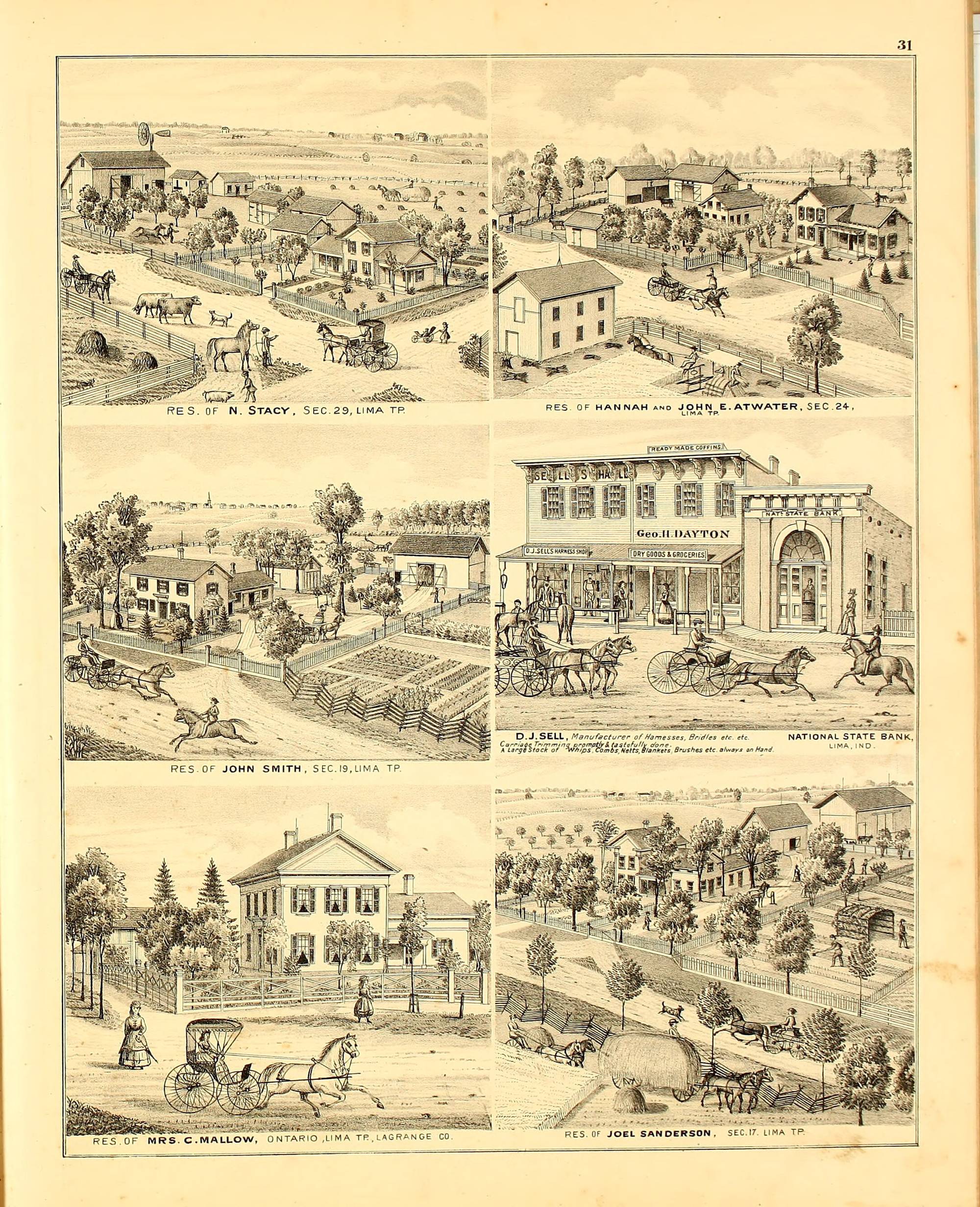
  • A page from an 1874 county atlas carrying six lithographed views in three rows of two, each in its own ruled panel with a caption in small spaced capitals beneath it. Five are farmsteads and houses with outbuildings, orchards, board fences and figures with horses, buggies and cattle on the roads in front of them. The sixth, at the middle right, is a street view of a block of stores with lettered signboards beside a bank with a tall arched doorway.

    LaGrange County

    Hannah and John E. Atwater

    Hannah Atwater was widowed in Lima Township in 1872 and dead by 1875, and every fact the county's books hold about her sits inside a biography of her husband or one of her sons. In 1874 an atlas plate put her name first. Its index left her out.

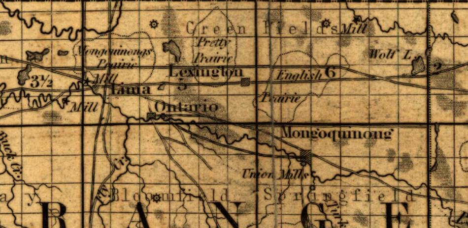
  • A detail from an 1852 map of Indiana showing the north of LaGrange County on a grid of numbered sections. At the left, in italic, the words Mongoquinongs Prairie sit beside the town of Lima. At the right, in upright letters, the word Mongoquinong labels a settlement symbol, and below it in italic the words Union Mills point to the same symbol. Lexington, Ontario, Green Fields Mill and the township names Bloomfield and Springfield are lettered around them.

    Mongo

    He took the office with him

    Two towns in this county have been called Mongoquinong. They are in different townships, and neither county history ever mentions that the other one existed.

  • A photographic portrait of an elderly woman, seated and facing the camera against a plain studio backdrop. She wears small oval spectacles and a dark high-necked dress with long sleeves, a lace jabot down the front and a small brooch at the throat. Her hair is drawn back under a cap of dark curled lace that sits close over her forehead. Her hands rest one over the other in her lap. The print is mounted square and its edge shows at the top and left.

    LaGrange County

    Still lives with Mrs. J. B. Nichols

    The 1893 county atlas photographed five of one family and printed them on a single leaf. One caption reads Miss Ann M. Bartlett. It is the only caption in the volume naming a woman who is not somebody's wife, and nothing in four volumes gives her a birth, a marriage or a death.

  • A detail from a printed town plat headed ONTARIO, at four hundred feet to the inch, dated Platted May 30 1837 and Add. May 31 1844. A river lettered PIGEON RIVER winds across the top of the sheet. A channel branching from it is lettered RACE, and two solid black buildings stand on it, lettered Flour Mill and Woolen Factory. Below the river a block of numbered lots is lettered JENKS ADD. across its face, with FRONT ST. and CANAL ST. beneath it.

    Ontario

    A controlling interest

    In 1836 Nathan Jenks told Lima he would bring the water power down a long race from Ontario. He got an act through the legislature, the route was staked, and the citizens of Lima signed the subscription books. Then he bought enough of the company to stop it.

  • The top of a large printed county map. A title in shaded capitals reads THE 1904 MAP OF LA GRANGE COUNTY, and beneath it in smaller letters BY SHEPARDSON AND RERICK, LA GRANGE, IND., and beneath that COPYRIGHT 1904. The paper is torn along the upper edge and mended with tape. Below the title the map begins: a grid of sections washed in pink, yellow and green, with the township names LIMA, GREENFIELD, CLAY and BLOOMFIELD lettered across it, the villages of Lima, Ontario, Brighton and Scott marked, Cedar Lake and Still Lake named, and every field inscribed with an owner's name and its acreage.

    LaGrange County

    Copyright 1904

    Samuel Shepardson kept this county's books for a decade and John Rerick wrote four chapters of its history. In 1904 the two of them made a map of who owned every acre in the county, and put their own copyright on it.

  • A detail from a printed map of Indiana showing the north-eastern corner of the state below the Michigan line. Large numerals mark the land cessions: 20 at the left, 18 in a band along the top below the state line, and 22 filling the ground beneath it. A heavy black line separates the 18 band from the 22 ground and runs east and west across the whole width of the sheet. A faint grid of survey townships lies under everything, and the village of Goshen is lettered just below the heavy line.

    LaGrange County

    Ten miles north of the southern extreme

    This county was signed away in two pieces seven years apart, at Chicago in 1821 and at St Joseph in 1828. The line between the two cessions runs east and west through the middle of the county, and neither county history mentions that it is there.

  • A detail from a printed township plat lettered LIMA TWP. down its right edge, with RANGE 9 E. down its left. The village of Lima is drawn as a hatched block at the centre bottom. A watercourse lettered PIGEON R. runs down the left of the sheet and another lettered RIVER down the right. Section numbers are printed large in the corners of the sections, including 13, and the landowners' names are written across their parcels. Nine of them read Craig, among them James Craig 80, Edith Craig 54, A. and E. Graig 108, J. B. Craig and Isaac Craig 28, whose parcel lies inside section 13.

    Lima Township

    The corpse was lying in the cabin

    The first white family to settle in this county reached their new cabin in the winter of 1828. The nearest house was one room with two families already living in it, and a dead child on the floor that no source ever names.

  • A detail of a hand-coloured township plat, the land washed pale pink and ruled into squares by solid and dashed section lines. At the right, section 13 is numbered and carries the name William Hayward with the figure 320 beneath it; along that section's western edge the name Caroline Hayward runs vertically with the figure 120. Section 14 is numbered to the left. Surrounding parcels are lettered with their owners and acreages: Est. Samuel Perkins 120, J. T. Hanna 111.4, John Langley 40, Wm. Herr 40, Socrates Cannon 40, Jacob Perkins 134, John A. Langley 120, Mary A. Dunbar 50, Isaac Perkins 80. Dense rows of short horizontal dashes, the mapmaker's mark for marsh, are drawn across much of the sheet, heaviest through sections 13 and 14. Small lakes are drawn as closed contour rings, one of them lettered Mud L. A heavy dashed line runs down the right side and along the top.

    Stroh

    Exclusively in the rich soil

    In 1899 William Hayward platted a village in the far corner of Milford Township, and it was first called Hayward. Within a year it was burning cement out of the bottom of a marsh.

  • A detail from a printed town plat, LaGrange north of Central Avenue, at four hundred feet to the inch. At the centre a full block is lettered COURT HOUSE and left open except for a solid black building drawn in the middle of it, bounded by Michigan Street, Spring Street, Detroit Street and Mountain Street. One block south a smaller black building on its own lot is lettered JAIL. The surrounding blocks are tinted pink and numbered by lot, with a railway running diagonally across them. At the upper left, outside the platted blocks and on open ground, a watercourse is drawn as a double line with marsh hatching beside it and lettered FLY CREEK.

    LaGrange

    Not, however, ungrateful

    In 1844 this county moved its seat of government onto a swamp at its own centre, and onto ground two men had an interest in. The 1882 history says they were materially benefited and then says they were not ungrateful. The 1920 history keeps the first half.

  • A full page engraving of a two storey brick building standing on a corner lot, drawn in stipple. It has a bracketed cornice, arched windows with heavy hoods, and two gabled pavilions breaking the roofline. Two separate front doors face the street, each reached by its own stone stoop and steps. A lower single storey wing runs off to the left, its windows smaller and set higher. An ornamental iron fence with looped pickets encloses the lot along both street fronts. Behind the building on the right stand a tall lattice windmill tower and a square water tank on posts, with a small outbuilding beside them. Four figures are on the walk: two women together at the fence, two more beyond them, and a man riding a horse in the roadway. Large trees stand at the right and behind the wing. The caption beneath reads La Grange County Jail.

    LaGrange

    The only couple ever married at the jail

    On the twenty-first of October, 1880, Sabra Stacy was married in the LaGrange County jail. Her father was the sheriff and the sheriff's house was one half of the building.

  • A detail of a township plat printed in black on cream, ruled into parcels by solid and dashed lines, each lettered with an owner's name and an acreage in a copperplate hand. In the lower right, the word TAMARACK is lettered along a heavy dashed boundary. Immediately above and left of it are three parcels named Granniss: O. P. Granniss 160, Rhoda Granniss, and E. B. Granniss 97.5 set vertically. A small cross and the letters M. E. Ch. mark a church beside them. To the west a lake is drawn as closed contour rings and lettered Nauvoo Lake. Other parcels carry B. F. Carey 271.75, Daniel Strayer 65, Jacob Sturgis 80, John 98 and a half, and Monroe. A railway crosses the upper part as a line hatched with cross ties, and section numbers 35 and 36 sit on the heavy lines. Rows of short horizontal dashes, the mapmaker's mark for marsh, run along the lower edge.

    Johnson Township

    Truly a bad place

    For fifteen years a Fort Wayne merchant sold whisky at a log tavern in Johnson Township to Potawatomi who came, the county history says, in great numbers. It records that without comment.

  • A detail of a township plat printed in black on cream, ruled into squares by heavy section lines and finer parcel lines. Near the centre, three words are lettered in block capitals inside one parcel, ROGERS ORPHANS HOME, with a small filled square beside them. Immediately west, a name runs vertically up its parcel, Erastus Nelson, with the figure 80. In the tier above, another parcel is lettered Erastus Nelson 37. The surrounding parcels carry owners and acreages in a copperplate hand: Jacob J. Miller 40, Mary A. Roy 40, Lydia Parks 40, Samuel Ritter 40, S. W. Roy 20, F. M. Nelson 63, Est. A. Henderson 80, J. W. Brayton 80, Alexandra Baker, Fred N. Patterson 40, David Miller 40, Reuben I. Deter, J. F. Todd 10. A railway crosses the sheet diagonally as a line hatched with cross ties. The section numbers 15 and 22 sit on the heavy lines, and the word CLEARSPRING is lettered at the foot beside a star.

    Clearspring Township

    Without money and without price

    Dr. David Rogers slept in a cave on his own land and left twelve hundred acres to the orphans of this county. Three books describe the man at length.

  • LaGrange County

    The presses did not die

    This county had fourteen newspapers before 1882. Most of them died inside two years, and their type went down the road and came out under a different masthead.

  • A detail of a hand-tinted county map, the land washed pale yellow and ruled into numbered squares. Eight lakes are drawn as irregular outlines with hatched shading along their shores, and each carries its name in italic lettering: Oliver L. and Olin L. through the middle, Dallas L. and Third L. to the west, Adams L. to the east, Witmer L. and Atwood L. along the south, and Nauvoo at the bottom right. The word JOHNSON is spread in large spaced capitals across the centre of the sheet. A railway runs down the map as a beaded black line. A red band along the foot carries WOLCOTTVILLE in white capitals, and below it, over the county line, sits Tamarack L.

    LaGrange County

    Thirty-five lakes

    This county had thirty-five lakes, from two or three acres up to six hundred, and one township held fifteen of them. Two books counted them and both got thirty-five.

  • LaGrange County

    Considerable discouragement from the neighbors

    A little before 1850 a doctor who had given up his practice began cutting a ditch into the Big Marsh in Eden Township. His neighbours tried to talk him out of it. Seventy years later a man from Clay Township owned ten steam dredges and the county had changed shape.

  • LaGrange County

    Wise enough to get rid of the stock

    About 1847 a company of Fort Wayne men laid fifty miles of three-inch oak plank from Fort Wayne up to Ontario. It was splendid for two or three years. Then the plank began to rot, and the men who had built it sold their shares to strangers.

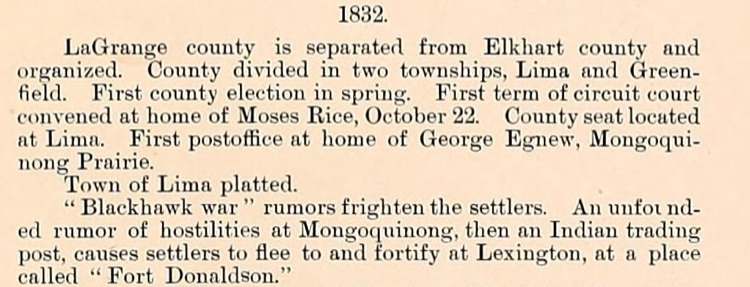
  • A cropped passage from the printed chronology of an 1893 county atlas. A centred heading reads 1832. Below it, small roman type in a single column: a paragraph on the county being separated from Elkhart county and organised, divided into two townships, its first election, the first term of circuit court, the county seat at Lima and the first postoffice. Then one line reading that the town of Lima was platted. The last entry runs four lines, opens with the words Blackhawk war in quotation marks, and ends with the words Fort Donaldson in quotation marks.

    Springfield Township

    Nobody in it at all

    In the summer of 1832 four or five men at a mill in Springfield Township played a joke on two of their neighbours. Within a day a hundred armed men had gathered, two forts were going up, and seventy-five Potawatomi were standing in a field holding a white flag.

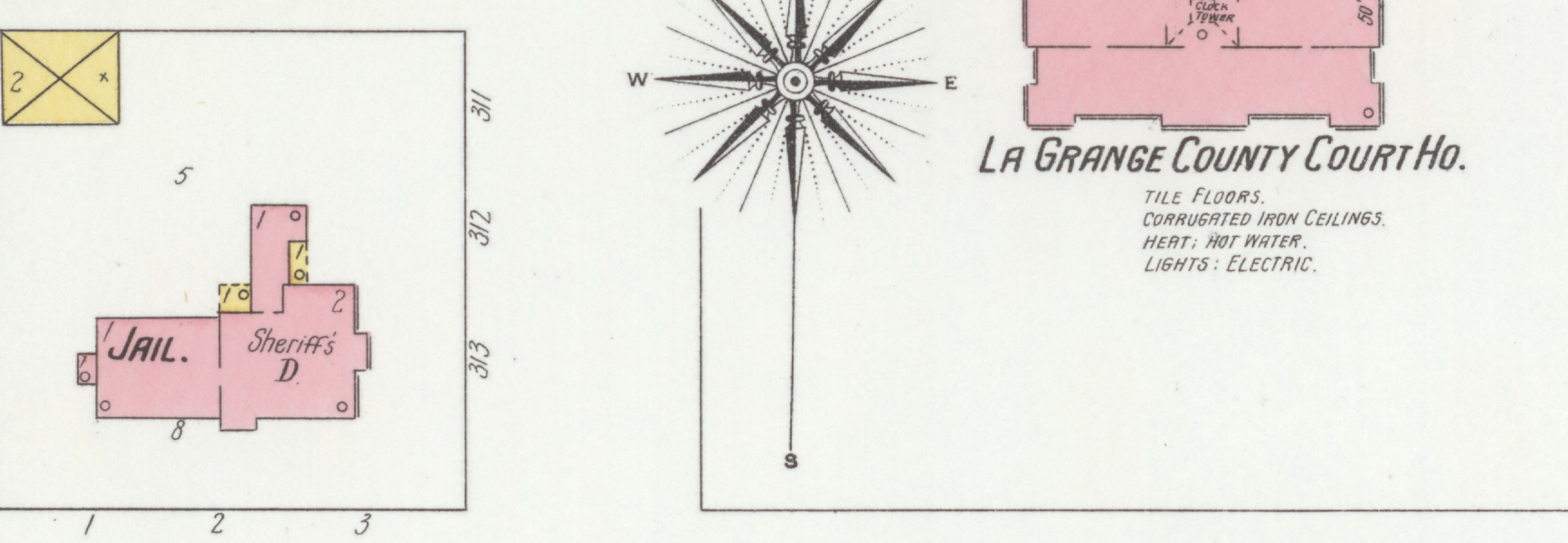
  • A detail from a 1901 fire insurance map of LaGrange. On the left, inside a fenced block numbered 311 to 313, two joined pink buildings lettered Jail and Sheriff's D. On the right, a larger pink building with a clock tower marked in its centre, lettered La Grange County Court Ho., with four notes below it reading tile floors, corrugated iron ceilings, heat hot water, and lights electric. A compass rose stands between the two blocks.

    LaGrange County

    A LaGrange County jury

    This county tried three men for murder in ten years and hanged none of them. Its own historian wrote down why, in one sentence, without appearing to notice.

  • LaGrange County

    A very fashionable performance

    In January of 1858 the county's vigilance companies arrested a man, tried him themselves, and hanged him from a tree near Diamond Lake. The people he was hanged for murdering turned out to be alive.

  • Van Buren Township

    She stops at the beach

    Addie Dwight was eighteen and she taught at the Lake Schoolhouse. On the twenty-second of June, 1871, she took her pupils down to Stone Lake at noon because she had promised them a frolic on the beach.

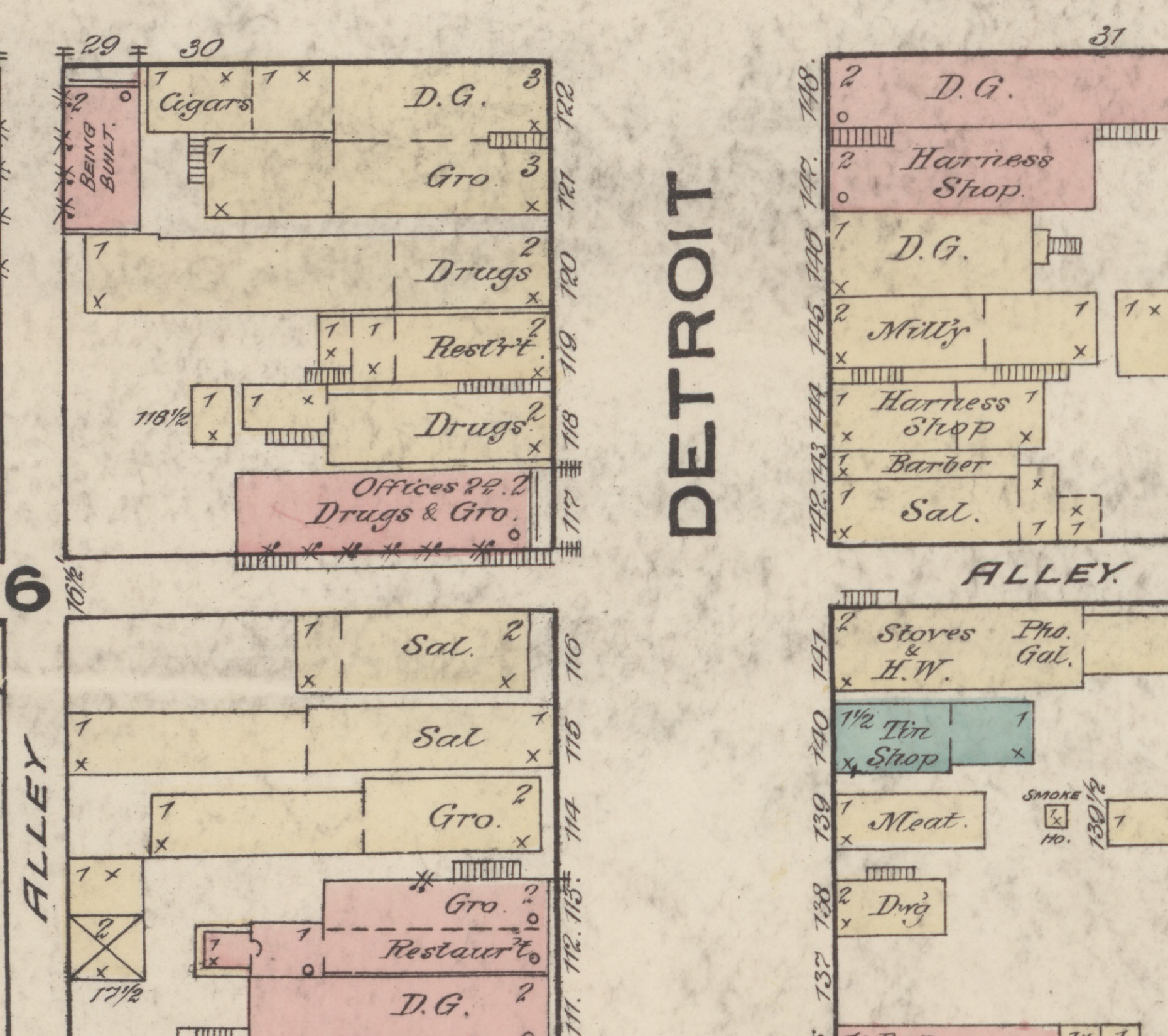
  • A detail from an 1883 fire insurance map showing both faces of Detroit Street in LaGrange, the street name lettered vertically down the middle. Buildings are drawn as coloured blocks with their trade written inside and the street number outside. On the west side, reading down, Cigars, dry goods, groceries, Drugs, a restaurant, and offices over Drugs and groceries; then, below a break, two adjoining buildings lettered Sal. at 116 and Sal at 115, a grocery at 114, and a bank at the foot. On the east side, dry goods, two harness shops, a millinery, a barber at 143, and a third building lettered Sal. at 142, with an alley below it. Storey counts and small crosses mark each building.

    LaGrange County

    A very temperate people, and six distilleries

    In 1857 twelve men in Mongo organised a lodge of Good Templars and stopped the sale of whisky in the village for ten months. When the lodge folded and a keg came back, three of them paid a young man three dollars to bore a hole in the bottom of it.

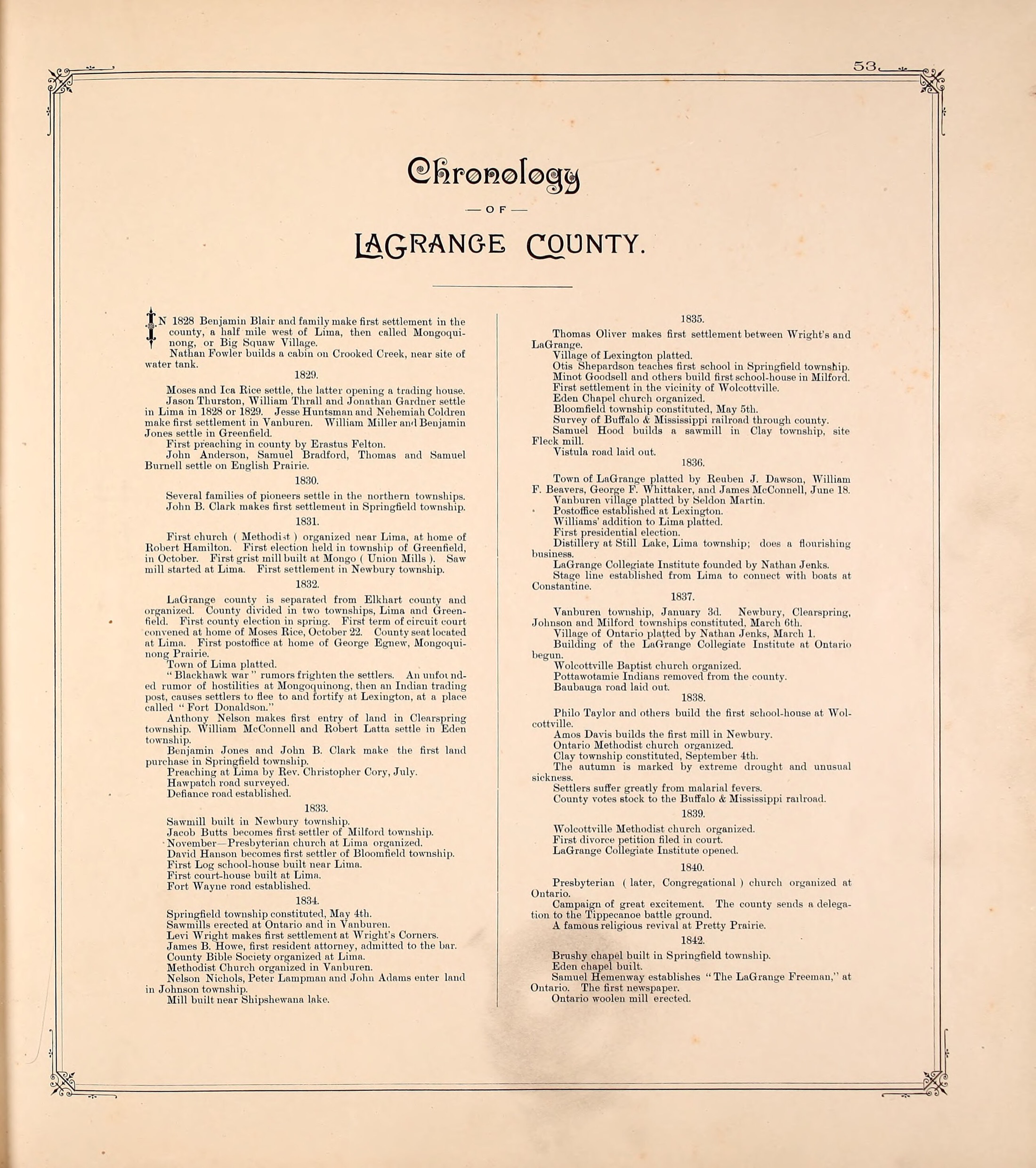
  • A printed page from an 1893 county atlas, headed Chronology of LaGrange County in ornamented type, the text set in two columns of small roman inside a fine ruled border with decorated corners. Years run as centred headings down each column, each followed by a short run of one line entries. The page is numbered 53 at the top right.

    LaGrange County

    One clause

    The county's 1893 chronology gives 1837 six paragraphs. A Baptist church organised at Wolcottville. A road laid out. A village platted. And, fifth of the six, the removal of the people who had lived here for centuries.

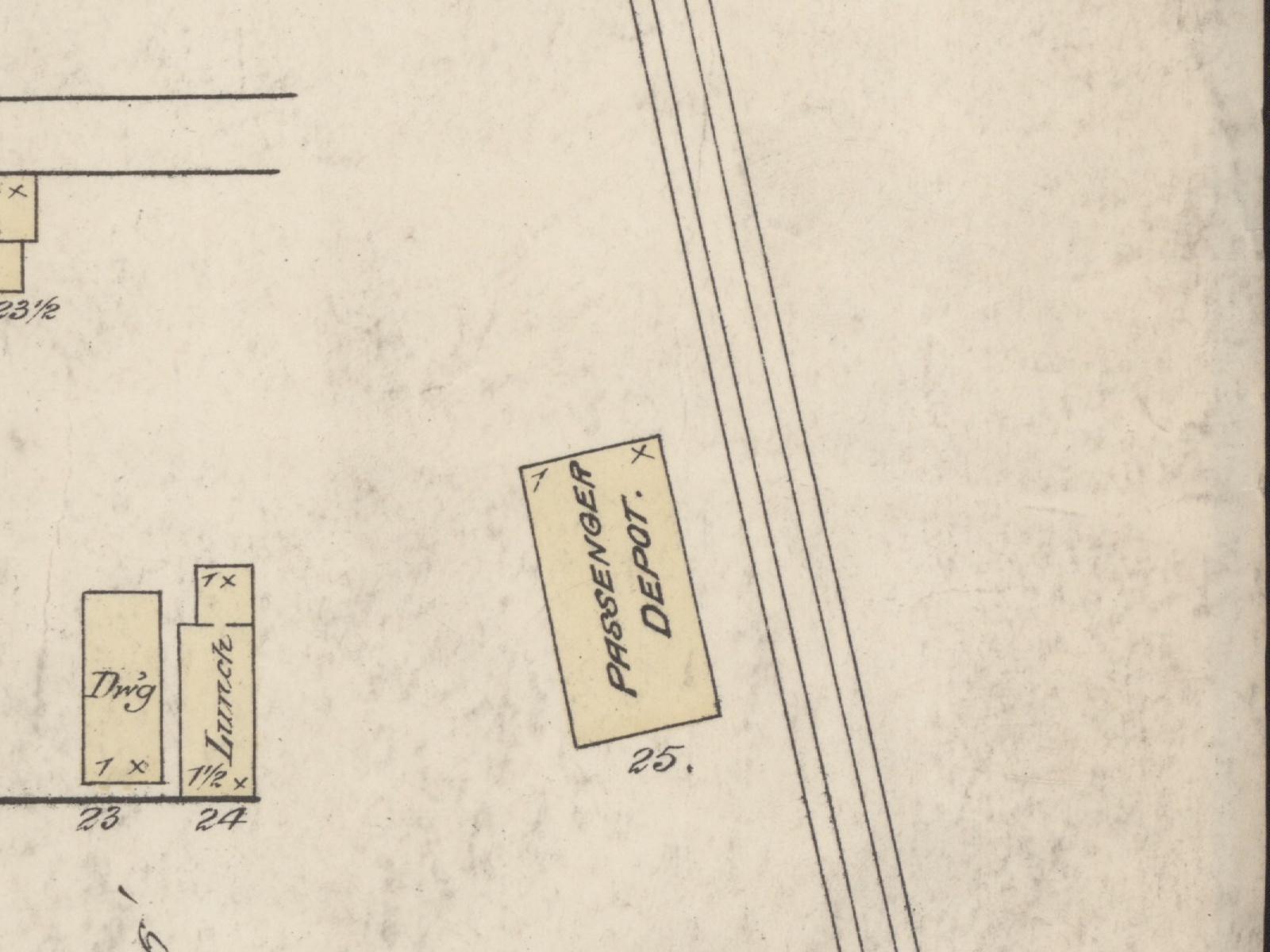
  • A detail of an 1883 fire insurance map, printed in black line with buildings washed in pale yellow. A rectangular building set at an angle to the sheet is lettered PASSENGER DEPOT and numbered 25. Four parallel lines run diagonally past it from top to bottom, the railroad. To the west stand two small buildings lettered Dwg and Lunch, numbered 23 and 24, and part of a scale bar shows at the lower left corner.

    LaGrange County

    The perverse running of the railway too far to the north

    When this county sent its men to the Civil War they walked to Fort Wayne, because there was no railroad. The first locomotive arrived in 1870 to a cannon and a band. Then four townships spent thirty years waiting for one that never came.

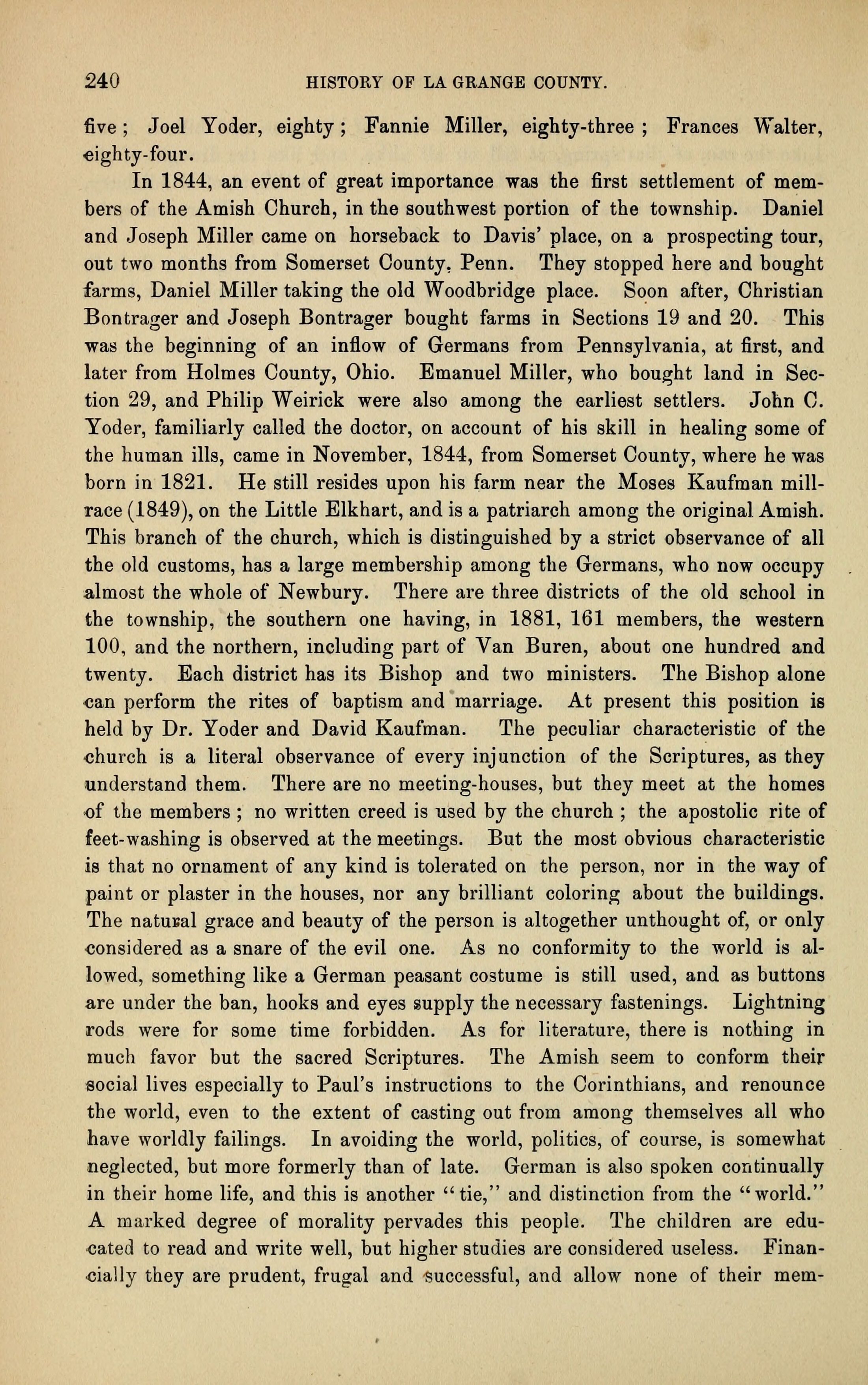
  • A printed page of an 1882 county history, a single column of set type on toned cream paper, numbered 240 at the top left beside the running head HISTORY OF LA GRANGE COUNTY. Unbroken body type from the top of the page to the bottom with no illustration and no paragraph break in the lower two thirds, the last line ending mid word on a hyphen.

    Newbury Township

    They kept dividing as they grew

    Amish families rode into Newbury Township in 1844 and bought farms. By 1920 there were seven congregations and about eighteen hundred members, and every one of the seven had split off from the one before it.

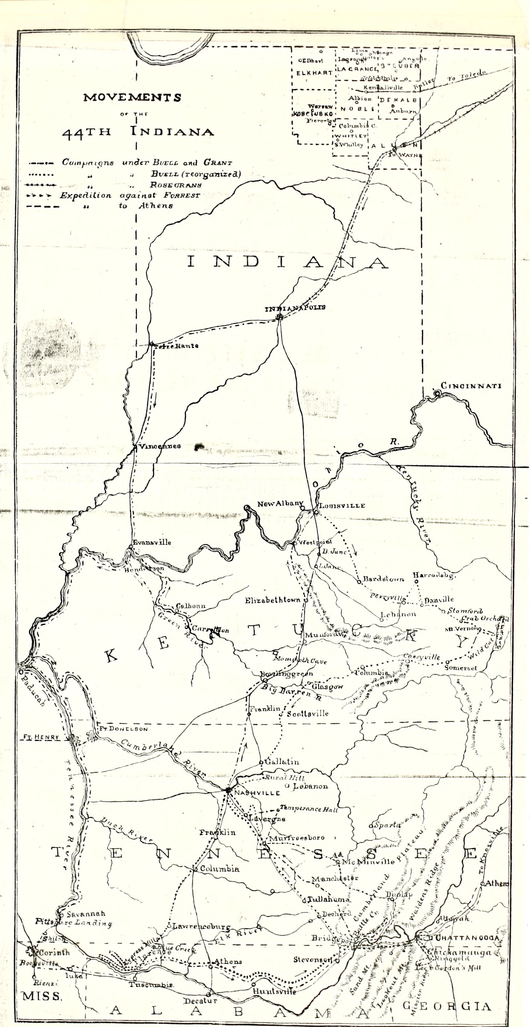
  • An engraved map headed MOVEMENTS OF THE 44TH INDIANA, printed in black line on toned cream paper, covering Indiana, Kentucky, Tennessee and the edges of Mississippi, Alabama and Georgia, with a legend of four route types and a corner inset of northeastern Indiana lettering LA GRANGE with the towns Lima and Lagrange marked.

    LaGrange County

    A county that had never seen a soldier

    In April of 1861 the courthouse filled to capacity, a man of seventy presided who had fought in 1812, and a doctor pulled from his pocket an enlistment paper he had already written. This county sent about fourteen hundred men to the war. Ninety-one said they would not go.

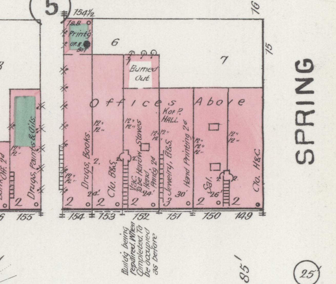
  • A detail from an 1892 fire insurance map showing the block east of the courthouse square. At the top left a small building lettered Print'g is shaded green for a special hazard, with Up. B. Bs't beneath it for an upper boiler in the basement. Below and right of it, an unshaded white rectangle interrupting the brick is lettered Burned Out. The storefront row beneath runs from 155 to 149 with each trade lettered, Offices Above across the middle, and a note in the street reading that a building is being repaired and when completed will be occupied as before.

    LaGrange

    What the county seat gained and lost

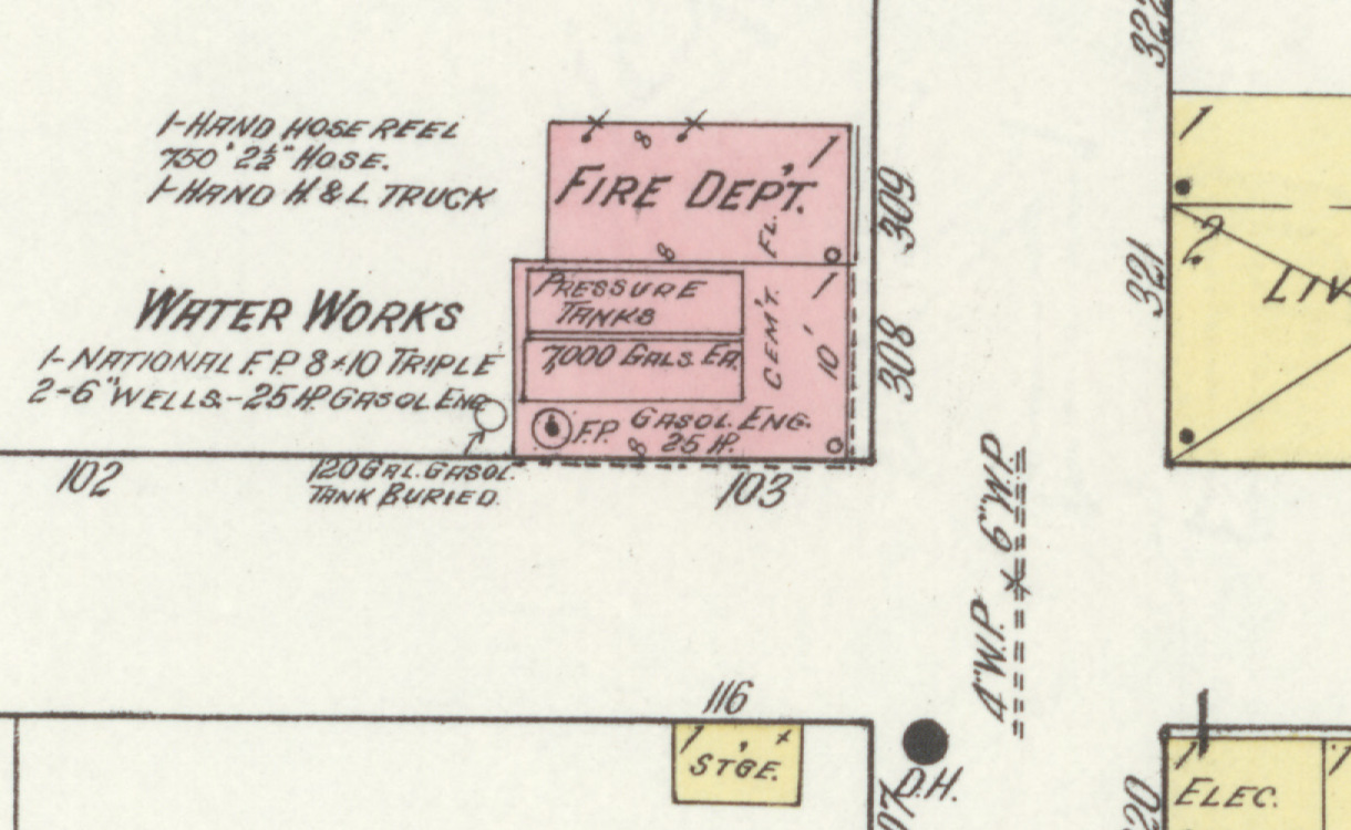
    Between 1901 and 1910 LaGrange got a telephone exchange, a fire station, a post office, a pickle factory and an ice cream factory. In the same nine years it lost two churches, a hotel and every printing office in town.

  • A detail from a 1914 fire insurance map. Two small brick buildings stand together on Race Street, one lettered Fire Dept and the other Water Works, with handwritten notes beside them listing a hand hose reel, seven hundred fifty feet of hose, a hook and ladder truck, a National fire pump, two six inch wells and a twenty-five horsepower gasoline engine. Pressure tanks of seven thousand gallons each are drawn inside. A buried gasoline tank is marked in the yard, a hydrant at the street corner, and four inch and six inch water pipe runs along the road.

    Wolcottville

    In a useless condition

    Nobody in Wolcottville wrote down how the town got water. The insurance company did, by accident, across twenty-seven years of coming back to price the risk of it burning down.

  • South Milford

    Known far down in the southern states

    Benjamin Waterhouse moved about a hundred people through Milford Township on their way to Canada. In 1854 the federal government tried him for it, and one of the witnesses against him was the brother of a former president of the United States.

  • Mongo

    One hundred twenty people at the same table

    In 1844, a hundred and twenty people from Indiana and Michigan moved into a single building in Springfield Township and started dividing the work by committee. The men who organized it were the same men who had organized the township.

  • Scott

    Resolved into wheat fields

    Van Buren Township has had three villages. One was dissolved by petition, one died when the railroad went somewhere else, and the third exists because of the railroad that killed the second.

  • A printed page of an 1882 county history, a single column of set type on toned cream paper, numbered 14 at the top left beside the running head HISTORY OF LA GRANGE COUNTY. Four paragraphs of body type describing marshes, prairies and a tract of land, followed by a fifth that opens with a quotation mark and runs to the foot of the page. No illustration.
    Topeka

    The Haw Patch had everything but a town

    It had the best soil in the county, the earliest settlers, two feuding founding families, a lynching, and a lecture hall that seated three hundred fifty. What it did not have, for sixty years, was a town.

  • Shipshewana

    The town came last

    Shipshewana was platted in January of 1889. Almost everything that makes it Shipshewana was already forty-five years old.

  • Wolcottville

    They wrote to Vermont for a teacher

    In 1851 Wolcottville had about a hundred people, a grist mill, a distillery, and no school worth the name. So the man who owned most of it wrote to a former governor of Vermont and asked him to send someone.

  • Brighton

    Two things that were not there

    In the summer of 1832 a hundred armed men gathered in Greenfield Township to put down a massacre that had not happened. Four years later, men in the East bought corner lots in a village that did not exist.

  • The LaGrange County Courthouse seen from the front walk, a red brick building with cream stone trim and a clock tower topped by a yellow dome, framed by two dark leaved maples, with a concrete walk running up to the arched entrance and marigolds along the edge of the lawn.

    Howe

    The town that has had three names

    Howe was called Lima for seventy-five years. Before that it was called Mongoquinong. It held the county seat, lost it, emptied out for sixty years, and then took the name of a lawyer who arrived before any of that happened.

The county

LaGrange County, Indiana. The eleven civil townships, every one of them now represented in the archive.LimaSpringfieldGreenfieldBloomfieldVan BurenMilfordClayJohnsonNewburyEdenClearspring
The eleven civil townships. The archive holds a piece set in every one.

Support the Gazette

Nothing on this site is behind a paywall and nothing on it is sponsored. If it has been worth something to you, there are three ways to give something back, and only one of them involves money.

Support the Gazette